
THE MAP THAT CHANGED HOW WE SLED IN BC
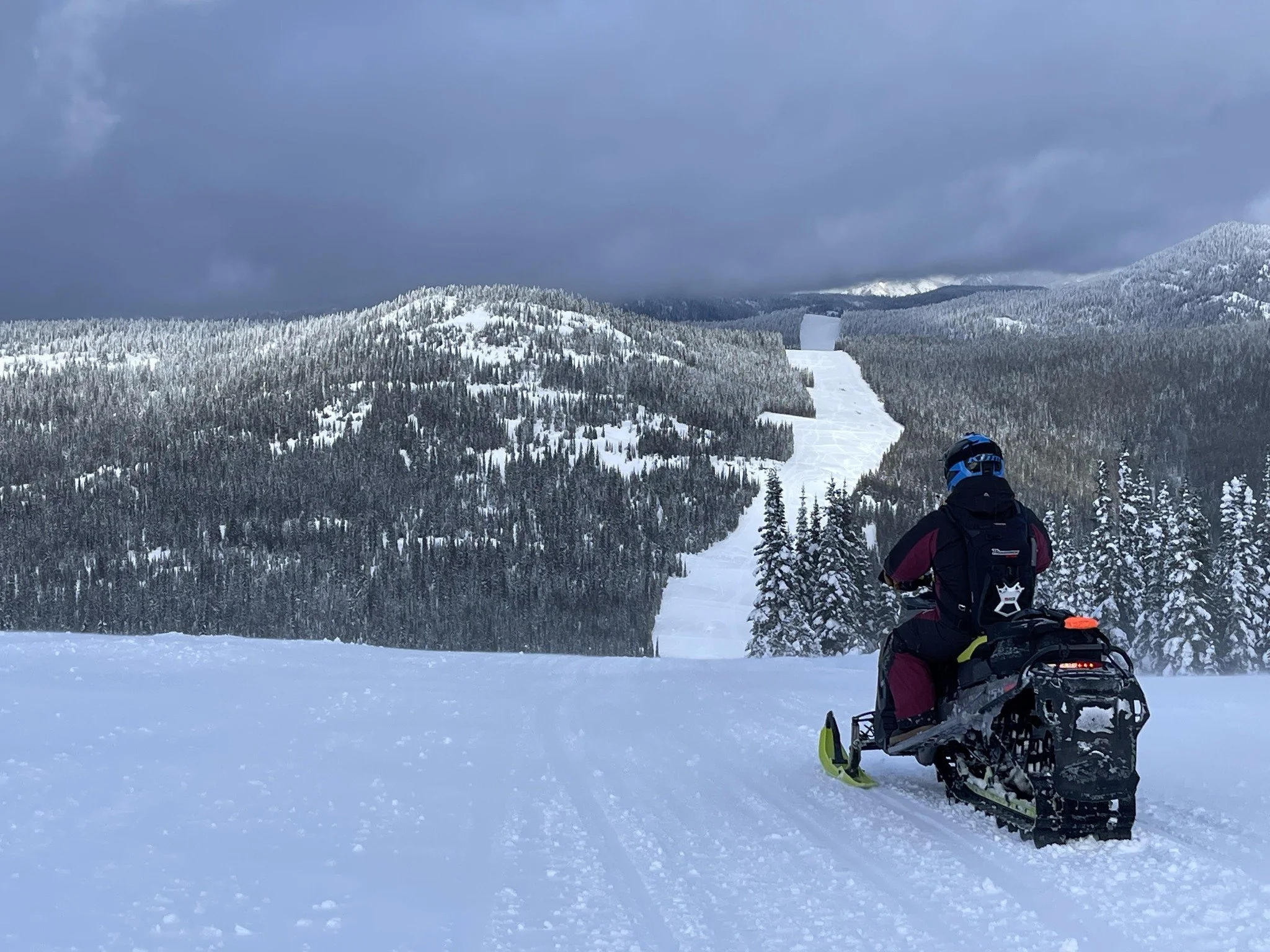
Snowmobiling in British Columbia has always required more than a good snow year. It’s a place where riding zones overlap with wildlife habitat, seasonal closures, and managed trail systems that exist because riders, clubs, and communities have worked hard to protect them. For years, understanding where you could ride meant piecing together local knowledge and outdated maps.
That’s exactly why the BC Provincial Snowmobile Trail Map exists.
Built by the BC Snowmobile Federation and funded largely through LetsRideBC, the map was created to give riders a clear, reliable way to explore BC—while respecting the systems that keep access open. Today, it’s quietly become one of the most valuable tools a rider can carry.
MORE THAN JUST TRAILS
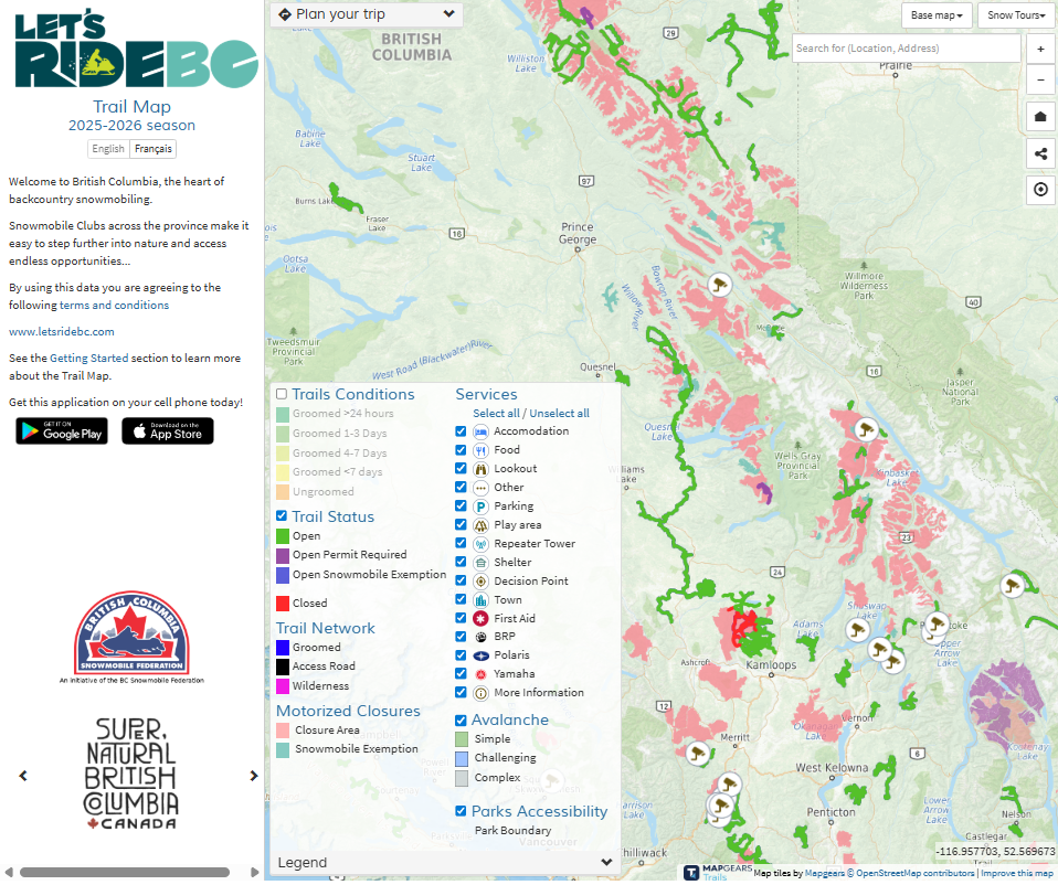
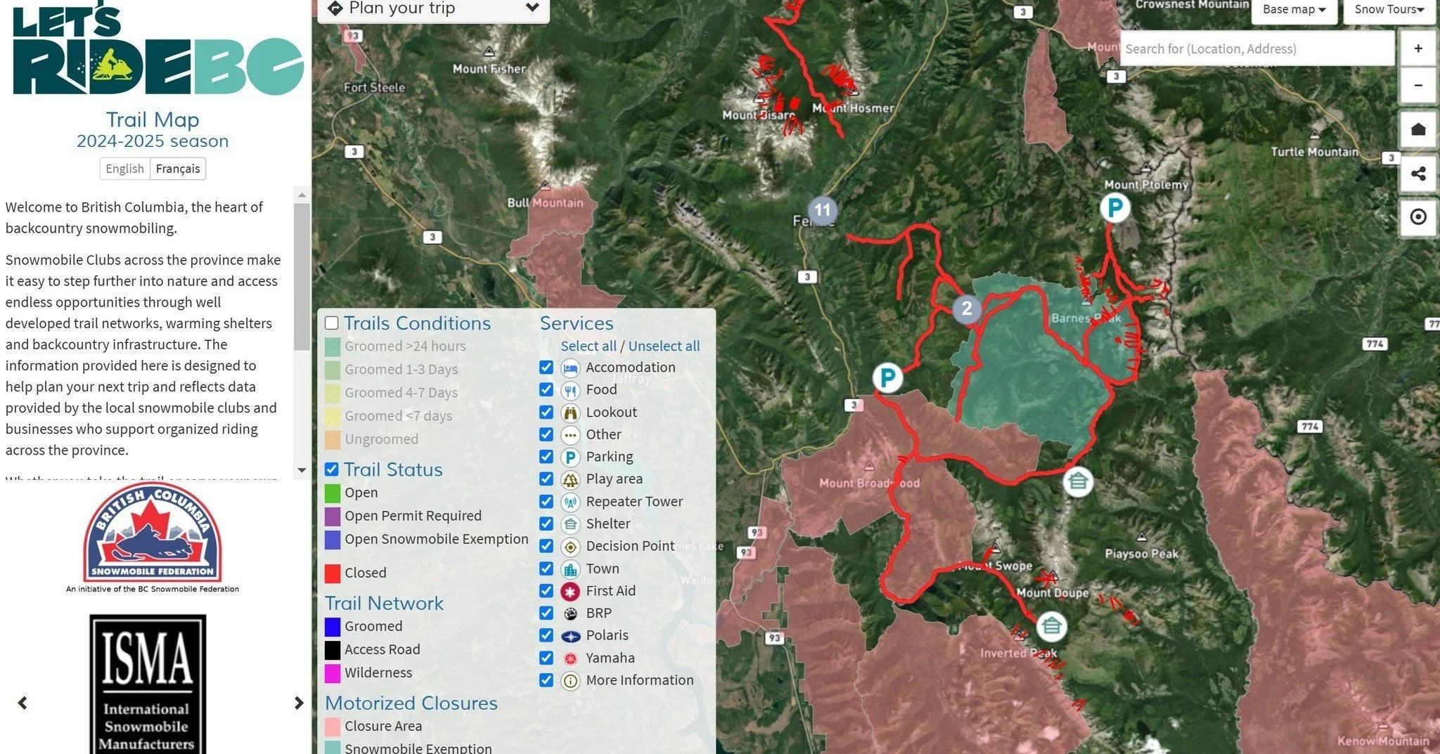
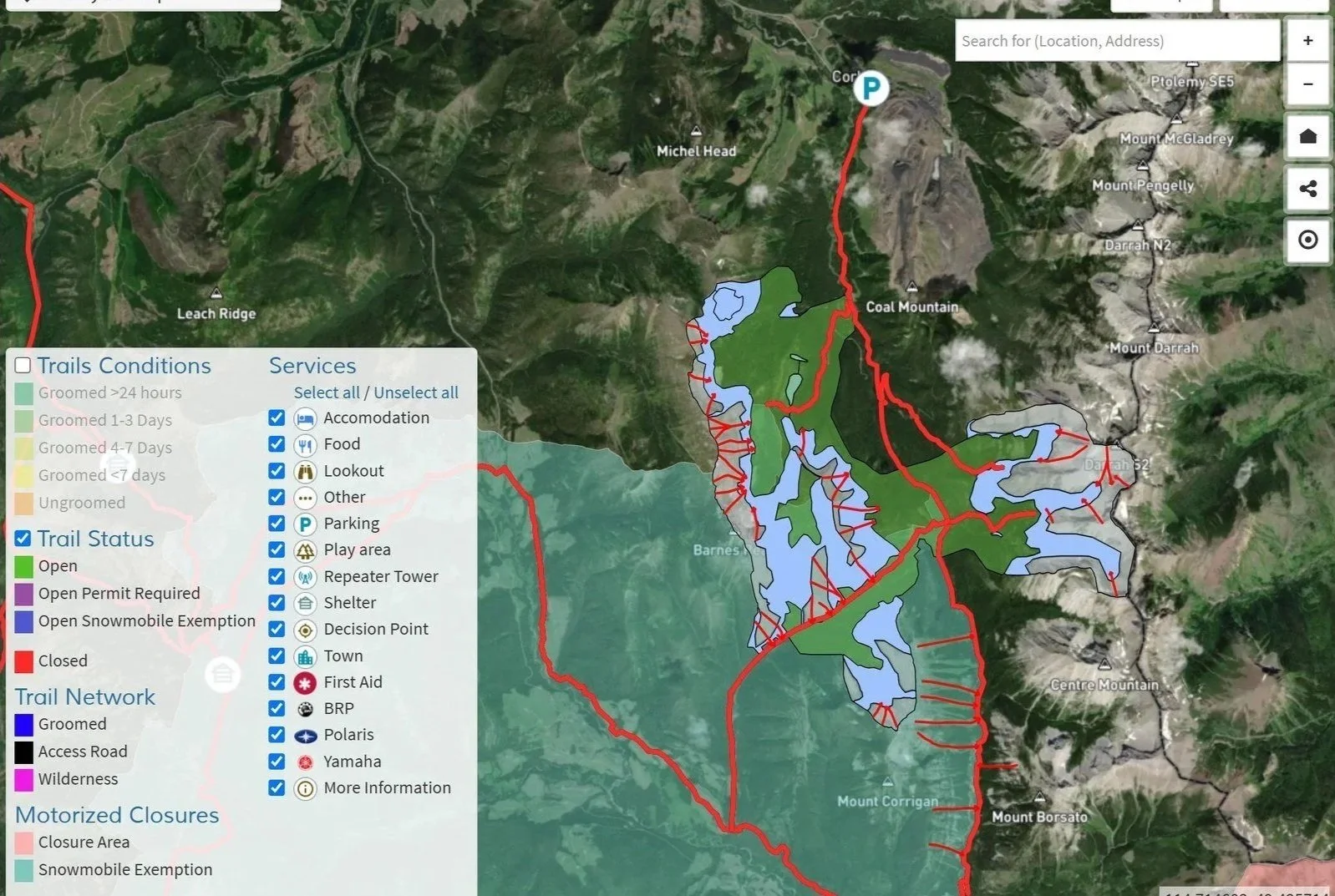
At its core, the map brings together more than 100 data layers into a single, living resource—many provided directly by the government and BC snowmobile clubs with on-the-ground knowledge of their riding areas and current regulations.
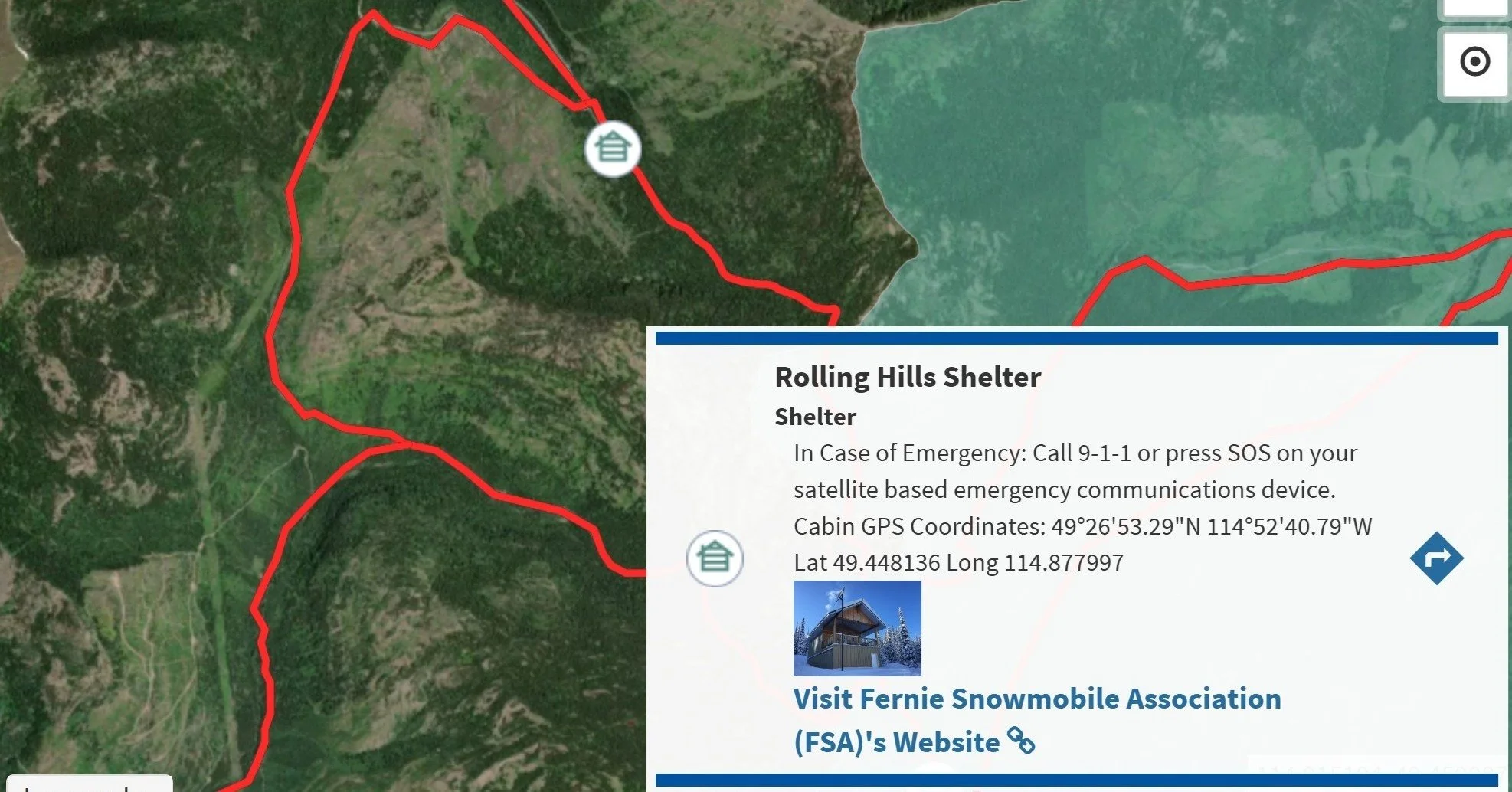
Riders can explore mapped riding zones across the province, including trail networks, cabins and shelters, safety caches, staging and parking areas, and live webcams showing current conditions. Trail status and infrastructure details reflect how riding is actually managed on the ground with links to grooming and conditions status, online trail pass purchases and more.
Layered on top of that is critical planning and safety information. The map includes Avalanche Canada’s Terrain Exposure Scale (ATES) to help riders better understand terrain and plan safer trips. It also shows motor vehicle closures, wildlife closures, and BC Parks and Protected Areas, adding essential context for where snowmobiling is permitted. One of the most unique features is the inclusion of dynamic wildlife closure polygons—adaptive access management zones that open and close in real time based on wildlife collar tracking data.
The map continues to evolve, with new resource layers added each season and ongoing refinements to improve performance and user experience.
WHERE TO FIND THE MAP
Most trips start at home, and the desktop version offers the clearest way to explore riding zones, understand closures, and plan multi-day trips before loading the sleds.
On snow, the map is integrated directly into in-dash displays on snowmobiles through BRP GO! and Polaris Ride Command. Both platforms provide official trail data, GPS navigation, offline map downloads, ride tracking, and group ride features—making it easier to explore confidently, even without cell service.
The map is also available on Garmin devices, including Garmin Tread series units and the Arctic Cat G8 Display, where riders can view trails and key points of interest.
WHAT’S NEW THIS SEASON
This winter marks another step forward. The BC Provincial Snowmobile Trail Map is now available as a standalone LetsRideBC app, offering a streamlined way to access BC-specific snowmobile information in one place.
It’s not about replacing the tools you already use. It’s about making good information easier to access. We are excited to see where this goes next as technology evolves!
WHY IT MATTERS
Behind the scenes, the map supports stewardship, compliance, and long-term access. For riders, though, it comes down to something simpler.
Better information leads to better trips.
However you ride, the BC Provincial Snowmobile Trail Map helps you explore British Columbia with confidence, respect the landscape, and make the most of every day on snow.